

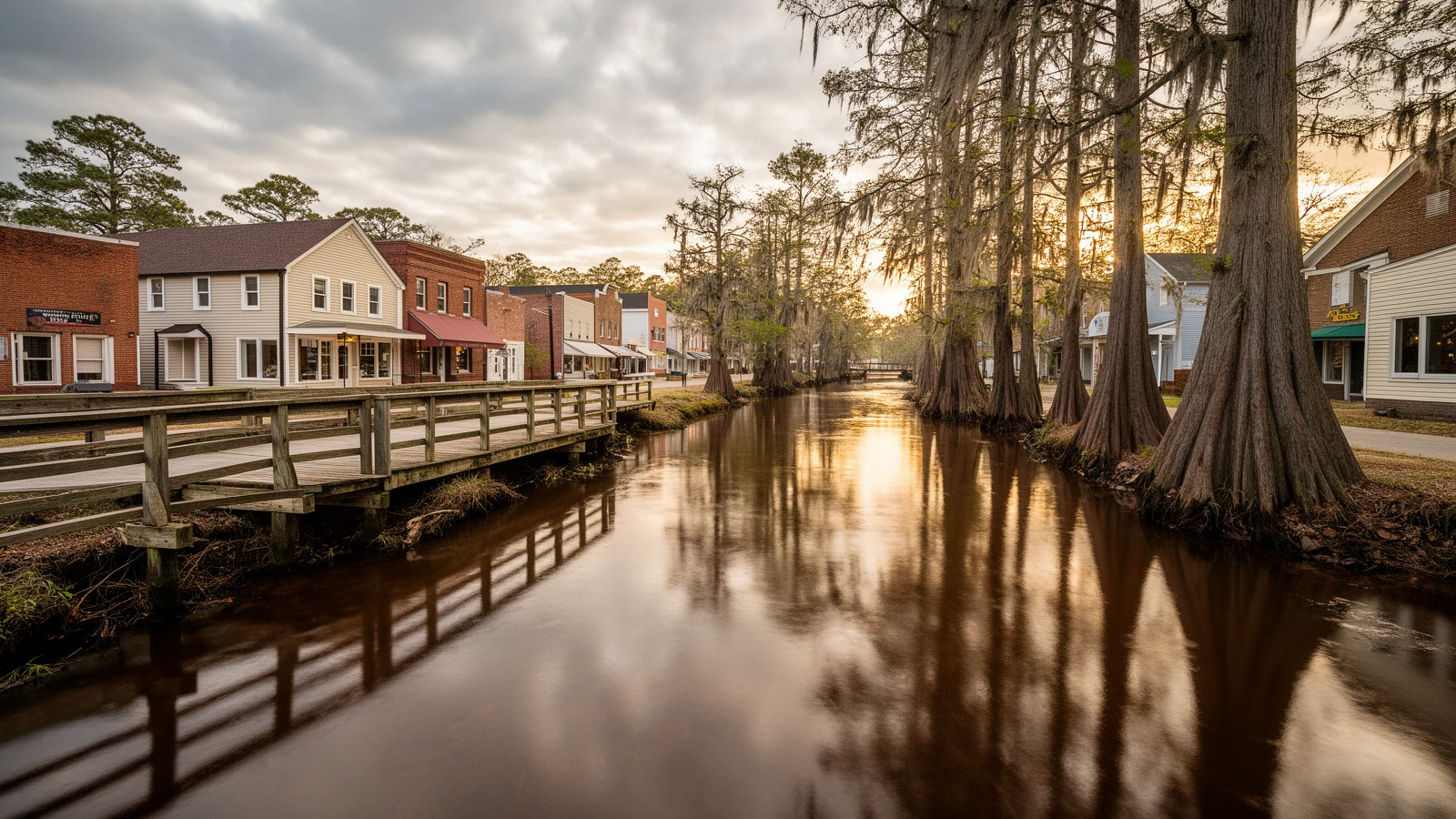
Tyrrell County sits on the southern shore of the Albemarle Sound, in the far northeastern corner of North Carolina's Coastal Plain — a county of blackwater rivers, peat wetlands, and open water, bounded on the east by the Alligator River. It is one of the oldest counties on the North Carolina map and, today, its least populous. That combination is not a coincidence. The land itself, wet and resistant to the plow, kept development away while the rest of the seaboard filled in — and what development couldn't take, conservation eventually claimed.
1729 Four Precincts, One County
Tyrrell County was established in 1729, formed from portions of Chowan, Bertie, Currituck, and Pasquotank — the old Albemarle precincts where North Carolina's earliest English settlement had taken root along the sound's shores in the previous century1. It was named for Sir John Tyrrell, one of the Lords Proprietors — the English noblemen who held the Carolina colony under charter from the Crown. The double-r, double-l spelling of his surname has confused visitors ever since.
At its creation, Tyrrell was a frontier of water more than land. Settlement clung to the sound shore and the banks of the Scuppernong River, and over the following century the county's boundaries were carved and re-carved as new counties — including neighboring Washington — were split away from it. What remained was the wettest, wildest heart of the Albemarle-Pamlico peninsula, and it has stayed that way since.
1793–1810 Elizabeth Town Becomes Columbia
The county's one town has a history that is, itself, unsettled in the record — worth stating plainly, since Columbia is Tyrrell County's only incorporated town and everything below about "the town" means specifically this one place. The settlement on the east bank of the Scuppernong River was incorporated in 1793 as Elizabeth Town2. Before it, the county's business had been conducted at Backlanding, the seat from 1774; commissioners selected Elizabeth Town as the new seat in 1799, and the first court convened there the following year3.
The rename to Columbia is where sources genuinely disagree, and this page states both rather than picking one silently. NCpedia, the State Library of North Carolina's encyclopedia project, dates the renaming to 1801. A separate local-history account, drawing on preservation records, dates it to 1810 and gives a specific reason: confusion with another Elizabethtown elsewhere in North Carolina3. Both years are in the record; nothing here resolves the gap.
Columbia is Tyrrell County's only incorporated town, and it has been renamed exactly once — the only real dispute is which year it happened.
What isn't disputed: Columbia has been the seat of Tyrrell County government ever since, and it remains the county's sole incorporated place. At the 2020 census it counted 610 residents, down from 891 a decade earlier — a courthouse, a riverfront, and the whole of downtown fitting into a few walkable blocks where U.S. Highway 64 crosses the Scuppernong.
1811 / 2001 The River That Named a Grape
The Scuppernong River is a blackwater river — its water stained dark by tannins from the swamps it drains — rising in neighboring Washington County and flowing through Tyrrell County into the Albemarle Sound. For most of the county's history it was the highway: settlement, trade, and timber all moved by water long before decent roads crossed the peninsula's wetlands.
The river also left its name on something far bigger than itself. In 1811 the bronze muscadine grape native to this region was formally named "scuppernong," after the river, the nearby lake (now Lake Phelps), and the Scuppernong settlement — all clustered in Washington and Tyrrell counties4. The word itself traces to an Algonquian term, variously recorded as askuponong, referring to a sweet bay tree. In 2001 the North Carolina General Assembly designated the scuppernong the official state fruit4. A county of a few thousand people can fairly claim naming rights to the state fruit of a state of ten million.
1784–1867 Somerset Place & the Pocosin Frontier
The defining fact of Tyrrell County's land is the pocosin — a word derived from a Native American term often rendered "swamp on a hill," describing the peat-soil shrub wetlands that blanket much of the peninsula. Pocosin soil is organic, spongy, and waterlogged; it resists the plow, the road grader, and the developer alike. The county's economic history is largely the story of attempts to make that land pay, and how incompletely those attempts succeeded.
The most ambitious of those attempts sat just across the county line. Josiah Collins and his partners formed the Lake Company around 1784 to drain and farm the swampland surrounding Lake Phelps in what is now Washington County, eventually acquiring more than 100,000 acres. The first shipload of enslaved Africans — roughly eighty people, aboard the ship Camden — arrived in June 1786 to begin digging the drainage canals by hand5. What became Somerset Place grew into one of the upper South's largest plantations, its enslaved workforce eventually exceeding 300 people, before the Collins family lost it to auction in 1867, two years after the Confederacy's defeat5. It stands today as a North Carolina State Historic Site — sobering regional context for how this peninsula's wetlands were first drained and worked, and at what human cost.
1926 The Scuppernong Swing Bridge
In 1926 the North Carolina State Highway Commission built a steel Warren pony-truss swing bridge across the Scuppernong River at Columbia — 566 feet long, with a 123-foot swing span that still pivots open by hand to let boat traffic pass6. It was listed on the National Register of Historic Places in 1992, and it holds a specific, verifiable distinction: it is the only manually operated pony-truss swing-span bridge remaining in North Carolina6.
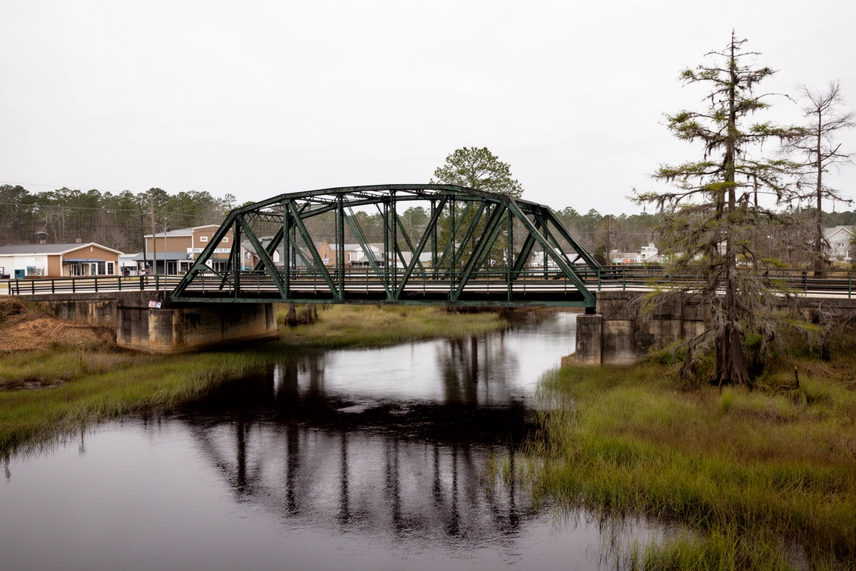
A century-old bridge that a human being still has to physically turn — in the middle of a downtown that fits in a few blocks.
1963–1990 Pungo to Pocosin Lakes
In 1963 the federal government established Pungo National Wildlife Refuge to protect waterfowl on the peninsula's lakes. In 1990, a much larger acquisition — the Conservation Fund's donation of more than 93,000 acres — created Pocosin Lakes National Wildlife Refuge around it, folding the older Pungo refuge in as its Pungo Unit7. The combined refuge now runs to roughly 110,000 acres across Tyrrell, Washington, and Hyde counties, headquartered in downtown Columbia.
The refuge remade the county's public identity as much as any single event since the courthouse moved to Elizabeth Town. More than 100,000 ducks, geese, and swans winter on its lakes and fields; the U.S. Fish and Wildlife Service describes its black bear population as among the densest ever reported; and the surrounding peninsula is home to the world's only wild population of endangered red wolves. A county whose economy once ran on draining wetlands now runs, in real part, on protecting the ones that never got drained.
2005 The Boardwalk & a New Identity
In 2005 the Scuppernong River Interpretive Boardwalk — a three-quarter-mile loop through cypress swamp connecting the refuge's visitor center to downtown Columbia — was designated a National Recreation Trail8. It put the county's oldest asset, the river, a short walk from anyone's parked car, and it made explicit what had been true for two centuries without a name: this county's water was never an obstacle to get past. It was, and is, the whole point.
Present Tyrrell County Today
Modern Tyrrell County is defined by what it kept rather than what it built. It remains North Carolina's least populous county — 3,245 residents at the 2020 census, across roughly 597 square miles of which about a third is water9 — with a working landscape of farms, timberland, and refuge around a single small county seat on the river. Columbia's own population has continued to shrink, from 891 residents in 2010 to 610 in 202010, even as the surrounding refuge and boardwalk draw more visitors than the town has ever housed.
The most significant infrastructure change here in a generation is already underway, though it sits just outside the county line. NCDOT awarded a $450 million contract in January 2025 to replace the aging Lindsay C. Warren Bridge over the Alligator River — the swing-span crossing that carries U.S. 64 traffic toward Manteo and the Outer Banks — with a fixed-span bridge; construction began that February, with the new span scheduled to open in 202911. For a county whose commuter arbitrage against Dare County real estate depends on that same drive, a fixed span that never has to stop for a boat is a real, if still years-off, change to the math.
For a home or land buyer, the history above is not decoration; it is the explanation. The county is affordable and uncrowded because the pocosins made it hard to develop. The hunting and wildlife are extraordinary because a third of the landscape is federally protected. The town is small because it never needed to be anything else, and its population has kept shrinking rather than growing. Whether that arithmetic appeals to you is the whole question this site exists to help you answer.
Primary Sources & Further Reading
The State Library of North Carolina's encyclopedia project. Source for the county's 1729 formation, naming, and the 1793/1801 Elizabeth Town record.
Somerset Place State Historic Site
NC Dept. of Natural & Cultural Resources. Preserves and interprets the Collins family plantation and drainage-era history at Lake Phelps.
Pocosin Lakes National Wildlife Refuge
U.S. Fish & Wildlife Service. Source for the refuge's 1990 establishment, the Pungo unit's earlier 1963 origin, and habitat/wildlife figures.
NCDOT — Lindsay C. Warren Bridge Replacement
Official project page for the Alligator River fixed-span replacement, contract award, and construction timeline.
Sources consulted for this page include NCpedia (the State Library of North Carolina's peer-reviewed encyclopedia project), the National Register of Historic Places nomination record for the Scuppernong River Bridge, NC DNCR's Somerset Place historic-site documentation, the U.S. Fish and Wildlife Service's Pocosin Lakes NWR history, the American Trails / National Recreation Trail database entry for the Scuppernong River Interpretive Boardwalk, NCDOT's own Lindsay C. Warren Bridge project documentation, and U.S. Census Bureau decennial counts. Where sources genuinely disagree — as with Elizabeth Town's exact renaming year — this page states both rather than picking one silently. Numbered citations for specific claims appear below. Dates and figures are stated as reported by those sources; nothing here is estimated or invented.
- Tyrrell County's 1729 formation from Chowan, Bertie, Currituck, and Pasquotank, and its naming for Sir John Tyrrell, a Lords Proprietor, per NCpedia's geography entry. NCpedia, "Tyrrell County," ncpedia.org/geography/tyrrell. ↩
- Elizabeth Town's 1793 incorporation on the Scuppernong River, per NCpedia's Tyrrell County entry (as above), corroborated by the Columbia, Tyrrell County town-history summary at LivingPlaces.com, drawing on North Carolina preservation records. ↩
- Backlanding as county seat from 1774; Elizabeth Town's 1799 selection as the new seat and its first court session in 1800; and the town's renaming to Columbia — dated 1801 by NCpedia's Tyrrell County entry (as above) but dated 1810, "apparently to avoid confusion with another Elizabethtown in North Carolina," by the LivingPlaces.com Columbia town-history summary, itself drawing on local preservation and NRHP-adjacent records. This page states both years rather than resolving the discrepancy silently. ↩
- The scuppernong grape's 1811 naming after the Scuppernong River, Lake, and settlement in Washington and Tyrrell counties, its Algonquian-derived name, and its 2001 designation as North Carolina's official state fruit by the NC General Assembly, per NCpedia's entry. NCpedia, "Scuppernong Grape," ncpedia.org/scuppernong-grape. ↩
- Josiah Collins's Lake Company (formed circa 1784), the June 1786 arrival of roughly 80 enslaved Africans aboard the ship Camden to begin the drainage works, the plantation's growth to over 300 enslaved workers, and the Collins family's 1867 auction of Somerset Place, per NC DNCR's official Somerset Place history. NC Historic Sites, "Somerset Place — The Site," historicsites.nc.gov/all-sites/somerset-place. ↩
- The 1926 construction of the Scuppernong River (Main Street) Bridge by the NC State Highway Commission, its steel Warren pony-truss swing span and 566-foot length, its March 5, 1992 National Register of Historic Places listing (Reference No. 92000078), and its status as the only manually operated pony-truss swing-span bridge remaining in North Carolina, per the National Register of Historic Places nomination record (prepared by Ray McClees and Laura Wolke through the NC State Historic Preservation Office, December 1991), as summarized in the Wikipedia-maintained index of that nomination. ↩
- Pungo National Wildlife Refuge's 1963 establishment and Pocosin Lakes National Wildlife Refuge's 1990 creation around it (via the Conservation Fund's donation of more than 93,000 acres), folding Pungo in as its Pungo Unit, per the U.S. Fish and Wildlife Service. USFWS, "Pocosin Lakes National Wildlife Refuge — About Us," fws.gov/refuge/pocosin-lakes/about-us. ↩
- The Scuppernong River Interpretive Boardwalk's 2005 designation as a National Recreation Trail, its three-quarter-mile length through cypress swamp connecting the refuge visitor center to downtown Columbia, per the American Trails / National Recreation Trail database entry. American Trails, "Scuppernong River Interpretive Boardwalk, Columbia, North Carolina," americantrails.org. ↩
- Tyrrell County's 2020 census population of 3,245 and its 597.18-square-mile total area (390.78 sq mi land, 206.40 sq mi water, roughly 34.6% water), per U.S. Census Bureau decennial figures as reported by NCpedia's Tyrrell County entry (as above) and independently corroborated demographic sources. ↩
- Columbia's population decline from 891 residents in the 2010 census to 610 in the 2020 census, per U.S. Census Bureau decennial counts as tabulated by North Carolina Demographics and corroborating census-derived demographic sources. ↩
- NCDOT's January 2025 award of a $450 million contract to Skanska USA to replace the Lindsay C. Warren (Alligator River) Bridge with a fixed-span crossing, construction beginning in February 2025 with the first foundation pile, and the new bridge's scheduled 2029 opening, per NCDOT's official project page and press release. NCDOT, "Lindsay C. Warren (Alligator River) Bridge Replacement," ncdot.gov/projects/lindsay-warren-bridge-replacement. ↩